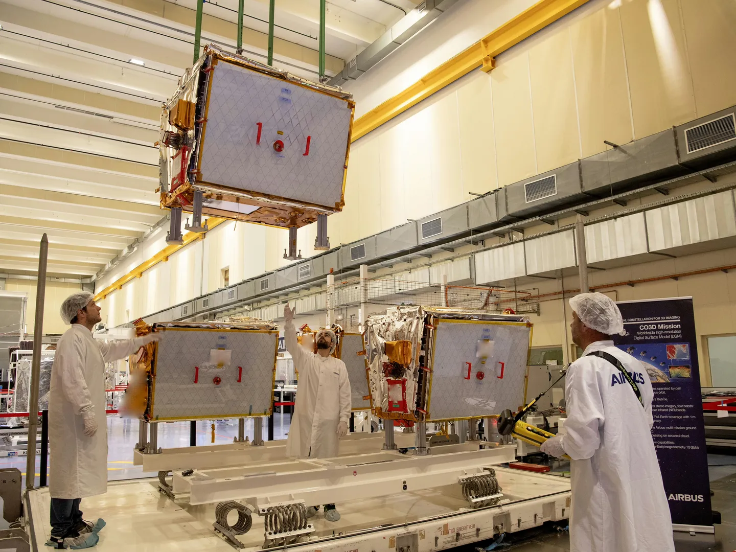
Paris – June 2025 – A new generation of optical Earth observation satellites, designed and manufactured by Airbus in partnership with the French Space Agency CNES, is en route to French Guiana for launch. The four CO3D (Constellation Optique 3D) satellites departed Toulouse, France, and are scheduled to lift off aboard an Arianespace Vega-C rocket from the European Spaceport in Kourou on July 25.
Developed for both civilian and military applications, the CO3D constellation will provide high-resolution digital surface modeling and stereo imagery at 50 cm resolution. These dual-use satellites will support CNES’s global DSM services and bolster Airbus’ existing portfolio of optical and radar satellite solutions.
“CO3D is more than just an operational upgrade—it represents a leap forward in technology, industrial processes, and commercial innovation,” said Alain Fauré, Head of Space Systems at Airbus. “Backed by CNES, this project reflects French ingenuity and advances our S250 platform, which is already generating interest amid growing geopolitical demands.”
Each of the four satellites weighs approximately 285 kilograms and is powered by full electric propulsion. Designed to operate for eight years, they will fly in pairs on opposite sides of the globe, with a 100 km spacing between each satellite in a pair. Operating from a heliosynchronous orbit at an altitude of 502 kilometers, the CO3D satellites will capture stereo images and contribute to a cloud-based ground segment managed by Airbus, with CNES providing the image processing systems. The resulting data will support the creation of an advanced 3D map of Earth’s land surfaces.
This map will serve both military requirements for accurate, up-to-date geographic intelligence and civil uses such as hydrology, geology, urban development, emergency response, and land management. After six months of in-orbit testing, the satellites will focus on mapping France and the “crisis arc” over an 18-month period before shifting to broader imagery missions.
The CO3D satellites feature several technological innovations. One satellite will carry LASIN, a laser communications demonstrator developed by CNES, which can achieve download speeds up to 10 gigabits per second—ten times faster than conventional X-band transmitters. Additionally, the satellites are designed to run onboard applications, including artificial intelligence or deep learning algorithms for identifying specific objects such as ships or aircraft. CNES will lead the first demonstration of this capability.
Equipped with advanced sensors, the satellites also feature a noise reduction mode that extends exposure time and enables image capture in low-light conditions. This enhancement allows for nighttime observation, including dark urban environments.
Looking Beyond CO3D
The CO3D program—and future satellites based on the S250 platform—benefits from Airbus’ experience with the OneWeb constellation, utilizing standardized components, an optimized supply chain, and efficient manufacturing inspired by automotive and aerospace production lines. Airbus’ Toulouse facility, where the satellites were assembled, incorporates full digitalization and smart tooling to streamline production.
Alongside CO3D, the Microcarb satellite will also be launched on the same Vega-C rocket. A collaborative mission between CNES and the UK Space Agency, Microcarb will carry a highly accurate Airbus-built spectrometer to monitor atmospheric carbon concentrations, helping scientists better understand carbon sources and sinks at a global scale.
Source Airbus